how to achieve xray style orthoimages
Posted: Fri Sep 12, 2025 9:38 am
hi,
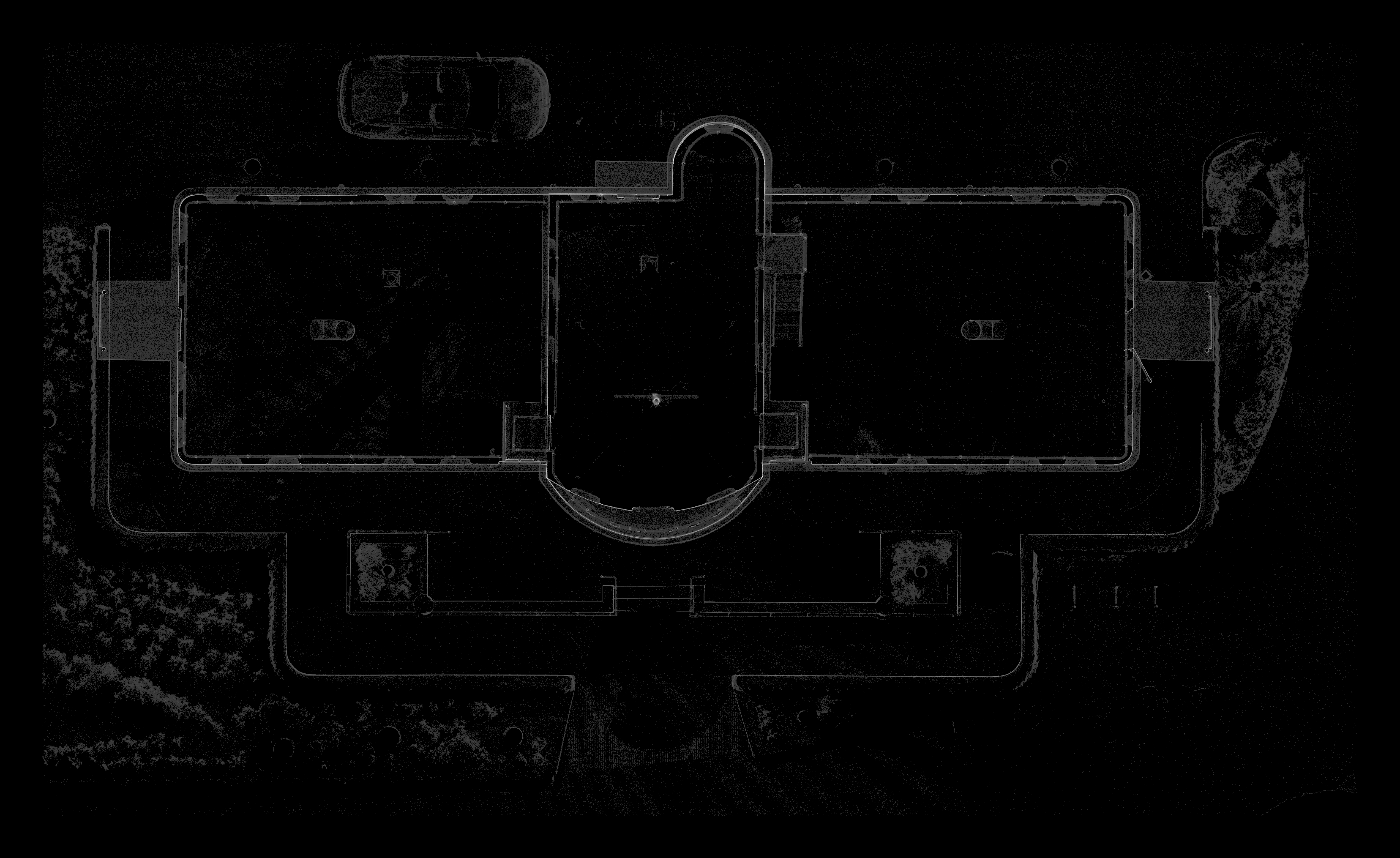
Is there a way to use the raster feature to make an xray style orthoimage ?
sample xray ortho here : https://quato.blob.core.windows.net/upl ... y_MVYG.png
To make an xray orthoimage you basically plot density, or point count over each xy cell - if more points occur above or below the xy cell, the score is higher and the xray image lighter.
For example a floorplan xray orthoimage would show walls as light areas, which makes for easy plan tracing to get a vector floorplan from the raster orthoimage.
I wonder if there is a way to achieve this, or would we need a fialog option "count" or "density" in addition to min/max/medium/average ??
[ ps. I notice in the code a mention of ccRasterGrid::PER_CELL_UNIQUE_COUNT_VALUE in ccRasterGrid.cpp.
This seems a similar computation : except we want a count of unique integer voxels above the xy cell occupied by points. This is better than raw point count, as it evens out the effect of higher density point counts closer to the scanner, lo some degree. nb, we want a count of occupied voxels, not the point or value count .. a voxel being a xyz cell above the xy cell of the raster ortho image ]
A related issue is .. if we want to get an orthimage of say a wall at an angle of 30deg from north, we would need to make a new sample pointcloud from that region, then use the raster feature .. there is no way to use the section tool local z axis / orientation ?